Downtown Franklin's historic districts sit inside the Franklin Special District, taxed at $2.2433 per $100 in 2026. ZIP 37064 value: $901,467 in September.
Last checked Oct. 17, 2026. Sources: the City of Franklin’s comprehensive plan, Envision Franklin, and its public map layers (subdivisions and the 2023 board-approved Williamson County Schools boundaries); the Franklin Special District’s school zones list; the Tennessee Department of Education’s 2024-25 letter grades; Zillow Research; and OpenStreetMap.
Downtown is Franklin’s oldest area: the Public Square and Main Street, and the streets of houses around them that the city protects as local historic districts. The city’s plan, Envision Franklin, describes the Main Street area as “the historic heart of Downtown Franklin,” running from the Harpeth River to beyond Five Points. For things to do, parking and the event calendar, see our downtown Franklin guide; this page is about living here.
What this means for you
- Zoned high school: Franklin High (north and west of the square) or Centennial High (south and east), both graded A for 2024-25. Kindergarten through eighth grade is the Franklin Special District.
- Home value: $901,467 in ZIP 37064 in September 2026, according to the Zillow Home Value Index.
- Nearest I-65 exit: exit 65 (Murfreesboro Road, State Route 96), about 3.3 miles by road from the Public Square.
Part of our Franklin neighborhoods guide.
Where it is
For this guide, downtown runs from the Harpeth River on the north and east to about Fair Street and West Main Street on the west and Lewisburg Avenue and Columbia Avenue on the south, with the Public Square at its center. Main Street (U.S. 31 Business and State Route 96) runs east and west through it; Hillsboro Road, Columbia Avenue, Lewisburg Avenue and Franklin Road lead out of it. All of it is in ZIP code 37064 and inside the city.
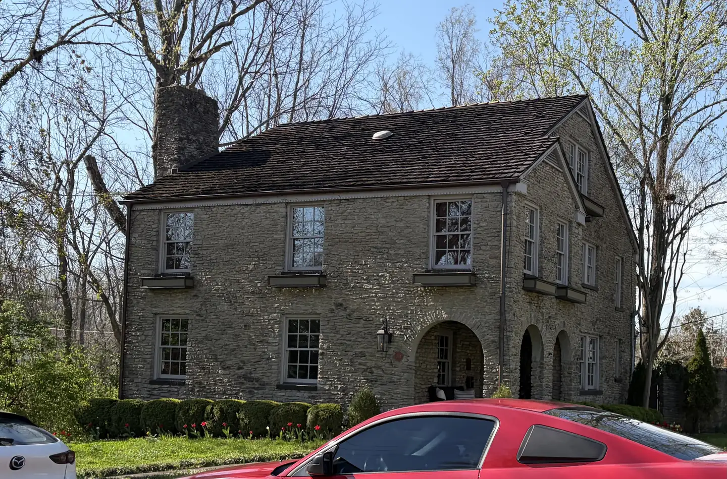
Envision Franklin puts most of the homes here in its Historic Residential design concept: established single-family streets “in and around Downtown Franklin,” generally more than 50 years old, including the Adams Street, Boyd Mill Avenue, Everbright Avenue, Franklin Road, Hincheyville and Lewisburg Avenue local historic districts. It names two more, Hard Bargain and Natchez Street, as walkable historic neighborhoods of “low-scale cottages, small building footprints, small lots, and shallow setbacks.” Exterior changes inside a local historic district go through the city’s Historic Zoning Commission; see our building permits and zoning guide.
The city’s subdivision map lists the original Town of Franklin plat (1800) and Hincheyville (1925) here, along with later streets such as Highland Gardens, Heath Place, Chestnut Bend and Sturbridge Pointe.
Schools
All of downtown is inside the Franklin Special District (FSD), which runs pre-K through eighth grade, so FSD, not the county, decides the elementary and middle school. Its school zones list splits downtown three ways. Grades are each school’s overall letter grade on Tennessee’s 2024-25 state report card.
| Level | School | Address | 2024-25 grade |
|---|---|---|---|
| Elementary | Franklin Elementary (Highland Gardens, Heath Place, Sturbridge Pointe, Yorktown, West End Circle) | 1501 Figuers Drive | A |
| Elementary | Johnson Elementary (the downtown Natchez area, Chestnut Bend, Harpeth Meadows) | 815 Glass Lane | B |
| K-8 | Poplar Grove (Magnolia Place, Orleans Estates, Rebel Meadows) | 2959 Del Rio Pike | A (K-4), B (5-8) |
| Grades 5-6 | Freedom Intermediate | 840 Glass Lane | B |
| Grades 7-8 | Freedom Middle | 750 New Highway 96 West | A |
| High | Franklin High | 810 Hillsboro Road | A |
| High | Centennial High | 5050 Mallory Lane | A |
FSD students go to Williamson County Schools for high school. In the 2023 board-approved boundaries on the city’s planning map, the homes north and west of the square, including the old Town of Franklin plat and Hincheyville, are zoned for Franklin High; Highland Gardens, Heath Place and the streets south and east are zoned for Centennial High. Check one address in the WCS zoned school finder and FSD’s map and zoning page. Renaissance High, a WCS school at 108 Everbright Ave., is downtown too (grade A). More in our schools guide.
Home values and taxes
The typical home value in ZIP code 37064 was $901,467 in September 2026, up 2.8% from $877,130 in September 2025, according to the Zillow Home Value Index. The index is a modeled typical value for the middle third of homes, not a sale price, and 37064 covers the south and west of the city, so it is not a figure for downtown alone. The City of Franklin figure was $913,277, up 3.0%.
Because downtown is inside both the city and the FSD, its 2026 property tax rate is $2.2433 per $100 of assessed value, the highest combined rate in Franklin, according to the Williamson County Trustee. More in our home prices and property taxes guides.
Parks and trails
City parks inside or touching downtown, from the city’s park layer and park pages:
- Bicentennial Park, near the Harpeth River at the north edge of downtown.
- Carter’s Hill Park and the Assault on the Cotton Gin Park, 1259 Columbia Ave., Battle of Franklin sites on Columbia Avenue.
- Collins Farm, 418 Lewisburg Pike: a 3-acre historic park.
- Thompson Alley Park, a small neighborhood park.
- Pinkerton Park, 405 Murfreesboro Road, and Fort Granger, across the river: see our Liberty Pike guide.
More in our parks and trails and walking and biking trails guides.
Getting around
- Interstate: I-65 exit 65 (Murfreesboro Road, State Route 96) is about 3.3 miles by road from the Public Square; exit 67 (McEwen Drive) is about 4.4 miles.
- Airport: about 22.5 miles by road to Nashville International Airport (BNA).
- Bus: both Franklin Transit routes start at the Downtown Transit Center at Main and Church streets. The Red Route stops at the Williamson County Library, 1314 Columbia Ave.; the Blue Route heads out Liberty Pike to Cool Springs, every 30 minutes, according to Franklin Transit.
Distances are measured on the OpenStreetMap road network with the OSRM routing engine; they are distances, not drive times. Exit numbers are as mapped in OpenStreetMap. Parking rules are in our getting around guide.
Groceries and everyday stores
From OpenStreetMap:
- Kroger, 595 Hillsboro Road, with a pharmacy, at the north edge near Mack Hatcher Parkway.
- CVS Pharmacy, Farrier Lane, near the Kroger.
- The nearest other supermarkets are on Murfreesboro Road near I-65; see the Liberty Pike guide.
How we drew this area
The area follows the Main Street and Historic Residential design concepts in Envision Franklin and the Harpeth River, checked Oct. 17, 2026. Subdivision names come from the city’s subdivision map layer; school zones from FSD’s zone list and the city’s copy of the 2023 WCS boundaries. Store locations are © OpenStreetMap contributors.
Frequently asked questions
What school district is downtown Franklin in?
Downtown Franklin is inside the Franklin Special District, which runs pre-K through eighth grade. Its students go on to Williamson County Schools for high school: Franklin High or Centennial High, depending on the street.
What are the historic districts near downtown Franklin?
The city’s Envision Franklin plan names the Adams Street, Boyd Mill Avenue, Everbright Avenue, Franklin Road, Hincheyville and Lewisburg Avenue local historic districts, plus the Hard Bargain and Natchez Street historic neighborhoods.
What is the property tax rate in downtown Franklin?
For 2026, homes inside both the city and the Franklin Special District pay $2.2433 per $100 of assessed value, according to the Williamson County Trustee.
Is downtown Franklin a good place to live?
Here are the facts. Downtown is the city’s oldest area, with six local historic districts and the Public Square, inside the Franklin Special District; its schools earned A and B grades on Tennessee’s 2024-25 report card, and the typical home value in ZIP 37064 was $901,467 in September 2026, according to Zillow.
Have your say