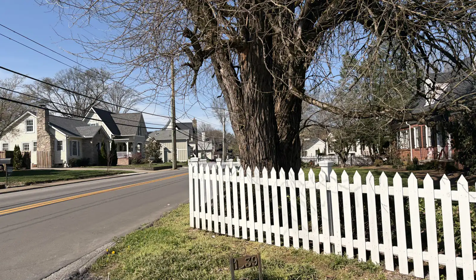
Franklin's 10 main areas, from downtown and Westhaven to Cool Springs and Berry Farms, with zoned high schools, ZIP codes and Zillow home values.
Last checked Oct. 17, 2026. Sources: the City of Franklin’s comprehensive plan, Envision Franklin, and its public map layers (city limits, ZIP codes, subdivisions and the 2023 board-approved Williamson County Schools boundaries); the Franklin Special District’s school zones list; the Tennessee Department of Education’s 2024-25 letter grades; Zillow Research; the Census Bureau’s QuickFacts; and OpenStreetMap.
Franklin is a city of about 87,000 people in Williamson County. Interstate 65 runs north and south through its east side, with exits 61 to 69 serving the city. Mack Hatcher Parkway (State Route 397) loops around the older center, and the Harpeth River winds through it. Downtown and the historic districts sit in the middle; the planned neighborhoods of the 1980s to 2000s spread west along New Highway 96 West and north along Hillsboro Road; the offices, shopping and apartments of Cool Springs line I-65; and the newest growth is in the south around the Goose Creek Bypass.
Three ZIP codes cover most of the city: 37064 for the south and west, 37067 for the east and Cool Springs, and 37069 for the north. A sliver near Moores Lane is in Brentwood’s 37027. ZIP codes and mailing addresses reach well beyond the city limit, so a Franklin address does not prove a home is inside the city.
Two public school districts share Franklin, and neither follows the city limit. The Franklin Special District (FSD) runs pre-K through eighth grade inside boundaries the state froze in 1986, the district explains; Williamson County Schools (WCS) runs the rest of the K-8 schools and every public high school. That split also changes the tax bill: for 2026, homes inside the city and the FSD pay $2.2433 per $100 of assessed value, and the rest of the city $1.566, according to the Williamson County Trustee.
What this means for you
- Check the address, not the neighborhood. WCS zones split several areas between high schools; use the WCS zoned school finder and FSD’s map and zoning page.
- Home values: $913,277 for the city in September 2026, and $901,467 to $998,910 across its three main ZIP codes, according to the Zillow Home Value Index.
- Inside or outside the FSD changes both the K-8 schools and the property tax rate.
The areas at a glance
| Area | ZIP | Zoned high school (2023 boundaries) | Typical home value in its ZIP, September 2026 | Guide |
|---|---|---|---|---|
| Downtown | 37064 | Franklin (north and west), Centennial (south and east) | $901,467 | Downtown |
| West Main and Boyd Mill | 37064 | Centennial (south), Franklin (north) | $901,467 | West Main and Boyd Mill |
| Westhaven | 37064 | Independence | $901,467 | Westhaven |
| Fieldstone Farms | 37069 | Franklin | $998,910 | Fieldstone Farms |
| Liberty Pike | 37064, 37067 | Centennial | $901,467; $941,539 | Liberty Pike |
| Cool Springs | 37067 | Centennial; Franklin for Gateway Village | $941,539 | Cool Springs |
| Carothers Parkway and McKays Mill | 37067 | Centennial, Ravenwood or Page | $941,539 | Carothers Parkway |
| Murfreesboro Road East | 37064, 37067 | Mostly Page; Centennial for FSD streets | $901,467; $941,539 | Murfreesboro Road East |
| Columbia Avenue and Lewisburg Pike | 37064 | Centennial | $901,467 | Columbia Avenue and Lewisburg Pike |
| Goose Creek and Berry Farms | 37064 | Independence (west of I-65), Page (east) | $901,467 | Goose Creek and Berry Farms |
Home values are the Zillow Home Value Index for the ZIP code, a modeled typical value for the middle third of homes, not a sale price. Several areas share a ZIP code, so the figure is the same for them and does not describe any one area. On the 2024-25 state report card, Franklin, Centennial, Independence and Ravenwood high schools were graded A and Page High B.
Map
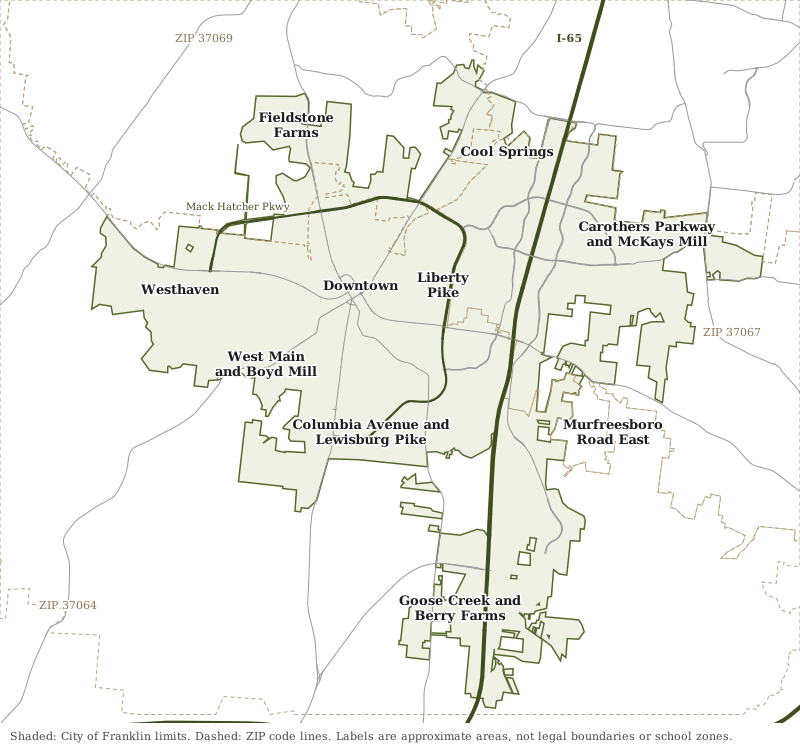
Map by Franklin News Today from the City of Franklin’s city limit and ZIP code layers. Roads © OpenStreetMap contributors. Area labels are approximate and are not legal boundaries or school zones.
Downtown
The Public Square, Main Street and the historic districts around them, including Hincheyville, Adams Street and Lewisburg Avenue, all inside the FSD. Read the downtown guide.
West Main and Boyd Mill
Older subdivisions west of downtown inside Mack Hatcher Parkway, from Rolling Meadows (1958) to Carlisle (2002), with Jim Warren Park. Mostly FSD, many zoned for Poplar Grove. Read the West Main and Boyd Mill guide.
Westhaven
The city’s largest neighborhood, approved in 2000 for 2,750 homes on New Highway 96 West, with its own town center, plus Franklin Green and Willow Springs. WCS from kindergarten; Independence High. Read the Westhaven guide.
Fieldstone Farms
A 1989 planned neighborhood of 2,146 homes on Hillsboro Road, with Fieldstone Park, Hunters Bend Elementary and a fire station. Zoned for Franklin High. Read the Fieldstone Farms guide.
Liberty Pike
East of the Harpeth River, from Hill Estates (1953) and Royal Oaks (1971) to the Factory District, with Pinkerton Park and Fort Granger. All FSD and Centennial High. Read the Liberty Pike guide.
Cool Springs
The shopping and office district west of I-65 around CoolSprings Galleria and Mallory Lane, mostly apartments, condominiums and townhomes. Mostly FSD and Centennial High. Read the Cool Springs guide.
Carothers Parkway and McKays Mill
East of I-65 from Moores Lane to Murfreesboro Road: McKays Mill, Ovation, Avalon, Cool Springs East and Liberty Park, split among three high schools. Read the Carothers Parkway guide.
Murfreesboro Road East
Newer neighborhoods such as Lockwood Glen and Simmons Ridge south of Murfreesboro Road and east of I-65, mostly zoned for Trinity Elementary and Page High, near the new Pearlene M. Bransford Complex. Read the Murfreesboro Road East guide.
Columbia Avenue and Lewisburg Pike
South of downtown on the 1864 battlefield: Forrest Crossing, Riverview Park and Charlton Green, with Eastern Flank Battlefield Park and Winstead Hill. Mostly FSD and Centennial High. Read the Columbia Avenue and Lewisburg Pike guide.
Goose Creek and Berry Farms
The growing south end at I-65 exit 61: Berry Farms and Stream Valley west of I-65, Ladd Park east of it, with unincorporated county land around them. Read the Goose Creek and Berry Farms guide.
Franklin in numbers
From the Census Bureau’s 2020-2024 American Community Survey five-year estimates for the City of Franklin, on QuickFacts:
| Measure | Franklin |
|---|---|
| Population | 87,133 |
| Median household income | $119,528 |
| Median value of owner-occupied homes | $705,400 |
| Homes that are owner-occupied | 63.8% |
| Mean travel time to work | 23.9 minutes |
These are survey estimates with margins of error. To see how Franklin compares with Brentwood, Thompson’s Station and Nolensville on taxes, schools and home values, read Franklin vs Brentwood vs Thompson’s Station vs Nolensville.
How we built this
The 10 areas come from the City of Franklin’s own sources. Its comprehensive plan, Envision Franklin, names Downtown and its historic districts, Westhaven, Fieldstone Farms, Charlton Green, the Factory District on Liberty Pike, Cool Springs, Carothers Parkway, Berry Farms and the Goose Creek Basin. The city’s subdivision map layer gives each subdivision’s name, approval year and approved dwelling units, and its city limit, ZIP code and fire station layers place them. Where the plan names no area, we used the main roads that divide the city (Murfreesboro Road, Columbia Avenue, Lewisburg Pike, I-65) and places OpenStreetMap names. We name no subdivision unless the city’s map or OpenStreetMap names it. School zones come from the city’s copy of the 2023 board-approved WCS boundaries and FSD’s zones list, grades from the state’s 2024-25 letter grade file, home values from Zillow’s ZIP and city files and distances from the OSRM routing engine on OpenStreetMap roads. All were checked Oct. 17, 2026.
More guides: home prices, schools, property taxes, moving to Franklin and getting around.
Frequently asked questions
What are the neighborhoods in Franklin, Tennessee?
This guide covers 10 areas drawn from the city’s Envision Franklin plan and map layers: Downtown, West Main and Boyd Mill, Westhaven, Fieldstone Farms, Liberty Pike, Cool Springs, Carothers Parkway and McKays Mill, Murfreesboro Road East, Columbia Avenue and Lewisburg Pike, and Goose Creek and Berry Farms.
What ZIP codes are in Franklin, Tennessee?
Most of the city is in 37064 (the south and west), 37067 (the east and Cool Springs) and 37069 (the north). Zillow put the typical home value at $901,467, $941,539 and $998,910 in those ZIP codes in September 2026.
Which high school will my Franklin home be zoned for?
Williamson County Schools runs every public high school. Franklin homes are zoned for Franklin, Centennial, Page, Independence or Ravenwood High, and zones do not follow neighborhood or city lines, so check the address in the WCS zoned school finder.
Why do Franklin property taxes differ by neighborhood?
Homes inside the Franklin Special District pay its school tax. For 2026 the combined rate is $2.2433 per $100 of assessed value inside the district and $1.566 in the rest of the city, according to the Williamson County Trustee.
What is the typical home value in Franklin, Tennessee?
$913,277 in September 2026, up 3.0% in a year, according to the Zillow Home Value Index, a modeled value for the middle third of homes, not a sale price.
Have your say