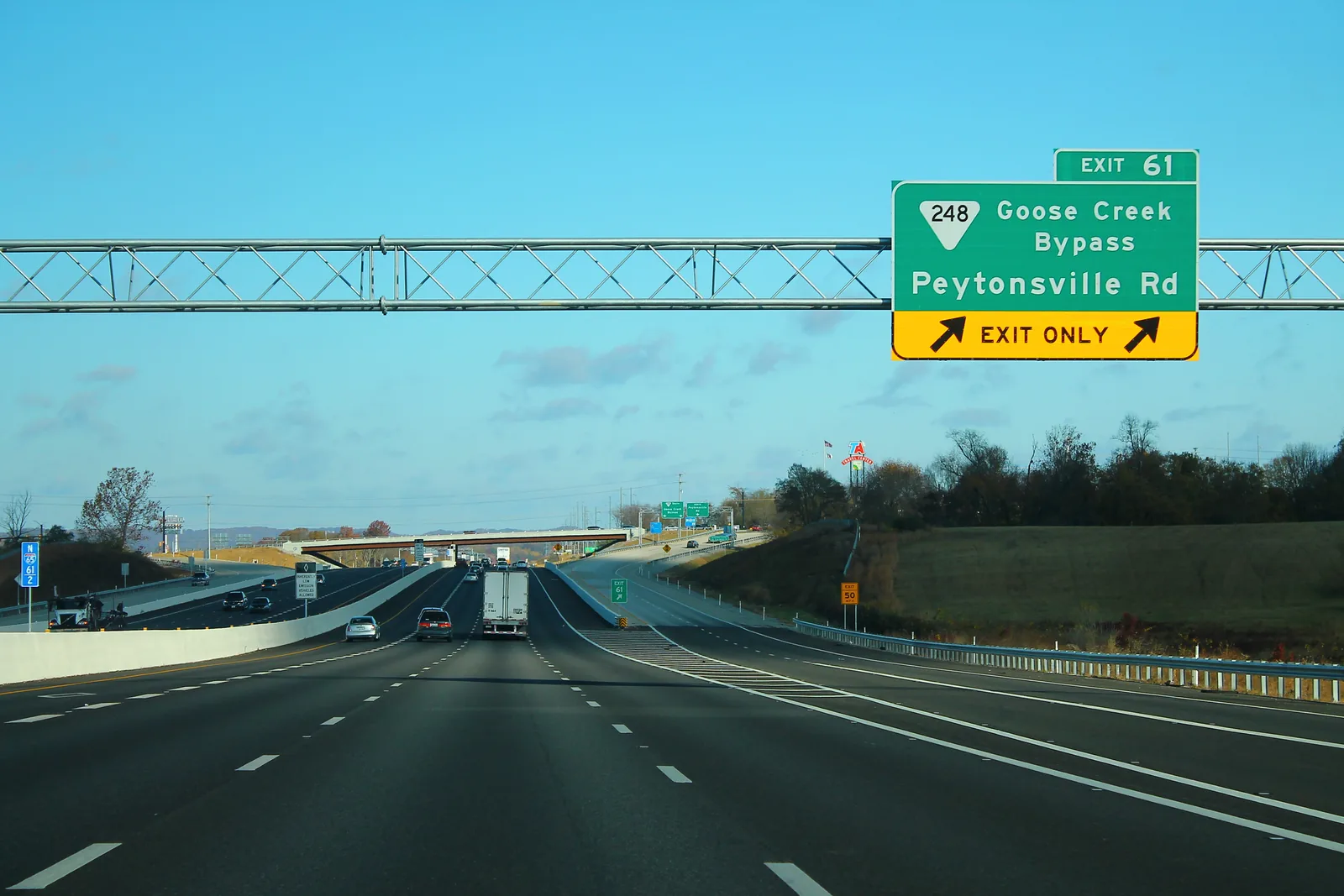
South Franklin at I-65 exit 61, where Berry Farms is zoned for Independence High and Ladd Park for Page High. ZIP 37064: $901,467 in September 2026.
Last checked Oct. 17, 2026. Sources: the City of Franklin’s Envision Franklin plan, its subdivision, city limit and school boundary layers; the Tennessee Department of Education’s 2024-25 letter grades; Zillow Research; the Williamson County Trustee; and OpenStreetMap.
Franklin’s south end is growing around I-65 exit 61, where the Goose Creek Bypass and Peytonsville Road (State Route 248) cross the interstate. The city’s plan, Envision Franklin, says that “anchored by the Berry Farms Town Center, major development is underway at the Goose Creek Bypass and I-65 interchange,” and expects the most population and job growth in the city in the Cool Springs and Goose Creek areas. Berry Farms, Stream Valley (824 approved homes, 2005) and The Villages at Southbrooke (2021) are west of I-65; Ladd Park and Foxglove Farms are east of it.
What this means for you
- Zoned high school: Independence High (west of I-65) or Page High (east of I-65), graded A and B on the 2024-25 state report card.
- Home value: $901,467 in ZIP 37064 in September 2026, according to the Zillow Home Value Index.
- Nearest I-65 exit: exit 61 (Goose Creek Bypass and Peytonsville Road), about 0.6 mile by road from Berry Farms.
Part of our Franklin neighborhoods guide.
Where it is
For this guide the area is the city’s south end, from about Henpeck Lane and Long Lane south to the city limit, on both sides of I-65, with Lewisburg Pike (U.S. 431), the Goose Creek Bypass, Carothers Parkway and Peytonsville Road as the main roads. All of it is in ZIP code 37064.
The city limit is ragged here. On the city’s map, Berry Farms, Stream Valley, Southbrooke and Ladd Park are inside it, but Goose Creek Estates, Henpeck Lane Estates, Heatherwood Hills, McLemore Farms and Mayberry Station are in unincorporated Williamson County, with county services and no city tax. The plan calls the Goose Creek Basin a short-term annexation area “due to the proximity of I-65, the ongoing buildout of Berry Farms, and the ability to extend gravity sewer infrastructure.” It also asks for a 150-foot setback along Peytonsville Road to keep its rural character, new homes off Long Lane set back like Ladd Park and Foxglove Farm, and Neighborhood Mixed-Use at the future meeting of Carothers Parkway and the Goose Creek Bypass.
Schools
The area is outside the Franklin Special District, so children attend Williamson County Schools from kindergarten, split by I-65 in the 2023 board-approved boundaries on the city’s planning map. Grades are each school’s overall letter grade on Tennessee’s 2024-25 state report card.
| Side | Elementary | Middle | High |
|---|---|---|---|
| West of I-65: Berry Farms, Stream Valley, Southbrooke | Oak View, 2390 Henpeck Lane (A) | Legacy, 2380 Henpeck Lane (C) | Independence, 1776 Declaration Way, Thompson’s Station (A) |
| East of I-65: Ladd Park, Foxglove Farms | Creekside, 4239 Glossy Hill Road (A) | Page, 6262 Arno Road (A) | Page, 6281 Arno Road (B) |
The county subdivisions along Columbia Pike to the west fall in the Winstead Elementary zone. Check one address in the WCS zoned school finder. More in our schools guide.
Home values and taxes
The typical home value in ZIP code 37064 was $901,467 in September 2026, up 2.8% from $877,130 in September 2025, according to the Zillow Home Value Index. The index is a modeled typical value for the middle third of homes, not a sale price, and 37064 covers the south and west of the city and county land beyond it, so it is not a figure for this area alone. The City of Franklin figure was $913,277, up 3.0%.
Inside the city, the 2026 combined rate is $1.566 per $100 of assessed value; in unincorporated county it is $1.30, according to the Williamson County Trustee. More in our home prices and property taxes guides.
Parks and trails
- Harpeth River access at Ladd Park, at the South Carothers bridge, is one of the city’s canoe put-ins, according to the city’s canoe access page.
- Pearlene M. Bransford Complex, a 180-acre city park between South Carothers Parkway and I-65, is under construction to the north; see the Murfreesboro Road East guide.
- Winstead Hill Park, 4023 Columbia Ave., is northwest of the area.
More in our parks and trails guide.
Getting around
- Interstate: I-65 exit 61 is about 0.6 mile by road from Berry Farms; exit 59, for I-840, is the next exit south.
- Downtown: about 5.9 miles by road to the Public Square.
- Airport: about 24.2 miles by road to Nashville International Airport (BNA).
- Bus: no Franklin Transit timepoint is in this area, according to Franklin Transit.
Distances are measured on the OpenStreetMap road network with the OSRM routing engine; they are distances, not drive times. Exit numbers are as mapped in OpenStreetMap. Franklin Fire Station 7 is at 4201 Long Lane. More in our getting around guide.
Groceries and everyday stores
From OpenStreetMap:
- Publix, 5021 Hughes Crossing Blvd., at Berry Farms.
- Kroger, 3054 Columbia Ave., to the northwest.
How we drew this area
The area follows the Goose Creek Basin and Berry Farms as Envision Franklin describes them, the city limit on the city’s map and the roads around exit 61, checked Oct. 17, 2026. Store locations are © OpenStreetMap contributors.
Frequently asked questions
What schools is Berry Farms in Franklin zoned for?
In the 2023 Williamson County Schools boundaries, Berry Farms, Stream Valley and Southbrooke are zoned for Oak View Elementary, Legacy Middle and Independence High.
What schools is Ladd Park zoned for?
Ladd Park and Foxglove Farms, east of I-65, are zoned for Creekside Elementary, Page Middle and Page High in the 2023 boundaries on the city’s planning map.
Is all of the Goose Creek area inside Franklin?
No. Berry Farms, Stream Valley and Ladd Park are inside the city, but many named subdivisions to the south and west, such as Goose Creek Estates and Henpeck Lane Estates, are in unincorporated Williamson County.
Is Berry Farms a good place to live?
Here are the facts. Berry Farms is a mixed-use town center at I-65 exit 61 with a Publix, zoned for Independence High, graded A on the 2024-25 state report card; the typical home value in ZIP 37064 was $901,467 in September 2026, according to Zillow.
Have your say